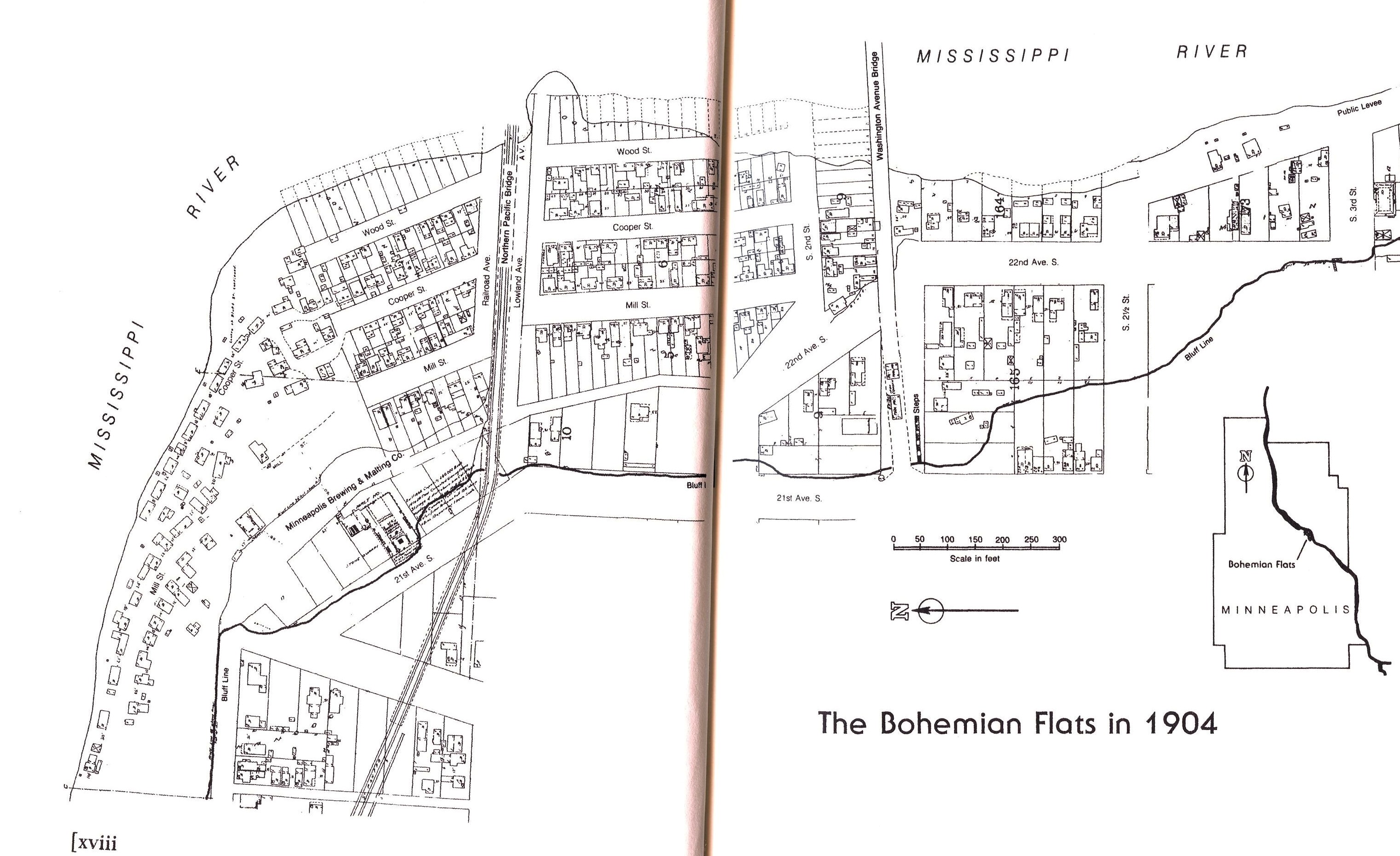
It’s map Monday. This map shows the Bohemian Flats in 1904, another lost world that is invisible to modern Minneapolitans. An ethnically-mixed enclave on the banks of the Mississippi River, the Bohemian Flats was a neighborhood of small houses and shanties constructed by new immigrants who were either unwilling or unable to pay the urban rents demanded in the rest of the city. Underneath the Washington Avenue bridge, down a wooden staircase from Seven Corners and Cedar-Riverside, these newcomers built a world that was removed from the rest of the city. Each morning, the male inhabitants of this neighborhood climbed up the cliff to work as day laborers or in a nearby lumber and flour mills. During the day these low-lying flats by the river were the territory of immigrant women and young children, who helped to support their families by scavenging wood, construction materials and other debris from the river. Residents supplemented scant wages with ambitious vegetable gardens that were nourished by annual floods that inundated the neighborhood.
The Bohemian Flats were described –with great nostalgia –in a slim volume put out by the Writers’ Program of the New Deal Era Works Progress Administration. This account casts the neighborhood on the flood plain as a “happy, peaceful society united by generous neighborliness and . . colorful rites and customs.” Upon publication, this characterization drew criticism from one Bessie Douglas, who had worked in the Flats as a Sunday school teacher for Westminster Presbyterian Church in the 1880s. Douglas presented a grittier vision of the Flats, describing how she could not visit her students without a male escort and police protection. The neighborhood was hardly idyllic as drunken fights and knifings were common among the residents, who included large numbers of prostitutes and alcoholics. Annual floods of the settlement prompted the city to clear the area of homes in the 1920s, prompted residents to riot. By the 1930s-when the work was being done on the WPA history of the Flats–most of the homes were gone and a barge landing had been constructed where the neighborhood once stood. Most recently, the site of the old Bohemian Flats was the depository for the wreckage from the collapsed 35W bridge. This map is taken from the WPA history of the Bohemian Flats, which was first published in 1941 by the University of Minnesota Press.
One thought on “Bohemian Flats”
Comments are closed.